Wednesday, April 25, 2012

FINAL PROJECT


KENAI PENINSULA

PART I - TIMELINE

Approximately 1000: Dena'ina Indians moved onto the western Kenai Peninsula.
1778: James Cook sailed his ships into his namesake inlet.

Map of south-central Alaska. Courtesy of Janet Schaefer, AVO/ADGGS.

1785 to 1791: Three redoubts or forts were established on the Western Kenai Peninsula by two Russian mercantile companies engaged in the fur trade. Alexandrovsk Redoubt (1785) was a Shelikhov Company post at Nanwalek, St George Redoubt (1786) was a Lebedev Company post established at the mouth of the Kasilof River, and St. Nicholas Redoubt (1791) was a second Lebedev Company post established at the mouth of the Kenai River.

1791: The Russian trading post, Fort St. Nicholas, was constructed at the present day city of Kenai for the purposes of fur and fish trading by the Russian-American Company. It was the second permanent Russian settlement in Alaska.

Ninilchik
The old Russian Village along the Ninilchik River.
1835: Ninilchik was founded as a Russian American Company retirement settlement for employees who were reaching pensioner age and wanting to remain in Alaska.  It also became a home for those who could not return to Russia because of debt laws and had become too old to work. 


1840: Alaska became a diocese of the Russian church and for the first time had a resident bishop.

1841: Bishop Innocent (Veniaminov) created six new parishes; including Kenai.  In the same year. the Russian-American Company employees built the first chapel at Fort St. Nicholas, dedicating it to the Assumption (into Heaven) of the Virgin Mary (Theotokos—Mother of God, as she is called by the Orthodox).

1844: Igumen (Abbot) Nicholas was the first priest to live at Kenai and serve the parish, which eventually included not just the fort and its community but also seven other communities, encompassing several hundred square miles.

Early 1860's: Abbot Nicholas started a school.  He also acted as arbiter between the officials of the Russian-American company and the natives.  His diaries report his activity in vaccinating the population, a practice ordered by Bishop Innocent.

1867: Russia sells Alaska to the United Stated and Alaska becomes a U. S. territory. U.S. Army units were deployed to secure the territory.

Fort Kenay Replica
1869: Battery F of the 2nd Artillery was sent to Kenai and built Fort Kenay at present day Kenai at the site of the old Russian-American Company post overlooking the river mouth. The Battery had attempted to establish the fort the year earlier, but the ship taking the men and supplies to Kenai, the U.S.S. Torrent, shipwrecked on Dangerous Cape in Kachemak Bay and the project was delayed a year.


1871: Fort Kenay was abandoned.

1883: A major forest fire burned on the peninsula creating optimal moose habitat.

Holy Assumption Orthodox Church, Kenai Alaska
ca. 1900, courtesy Anchorage Museum of History and Art.
1894: The Holy Assumption of the Virgin Mary Russian Orthodox Church was built in Kenai. (It is still in use today.)


1896: At Ninilchik, a school was built and staffed by Russian Orthodox priests and laymen.

1897: First sport hunter arrived on Kenai Peninsula. Dall DeWeese from Canon City, CO.

By 1900: Five schools were operating in the Kenai parish, all under the direction of the Russian Orthodox church.

picture of Ninilchik And Russian Orthodox Church Image
Ninilchik Russian Orthodox Church in front of Mt. Redoubt
1901: The Russian Orthodox Church was redesigned and constructed at its current site in Ninilchik.


1904: Forest Ranger William A. Langille travelled the Kenai Peninsula from Seward to Seldovia.  During this trip, he realized the unique value of the land as a wildlife and hunting preserve.
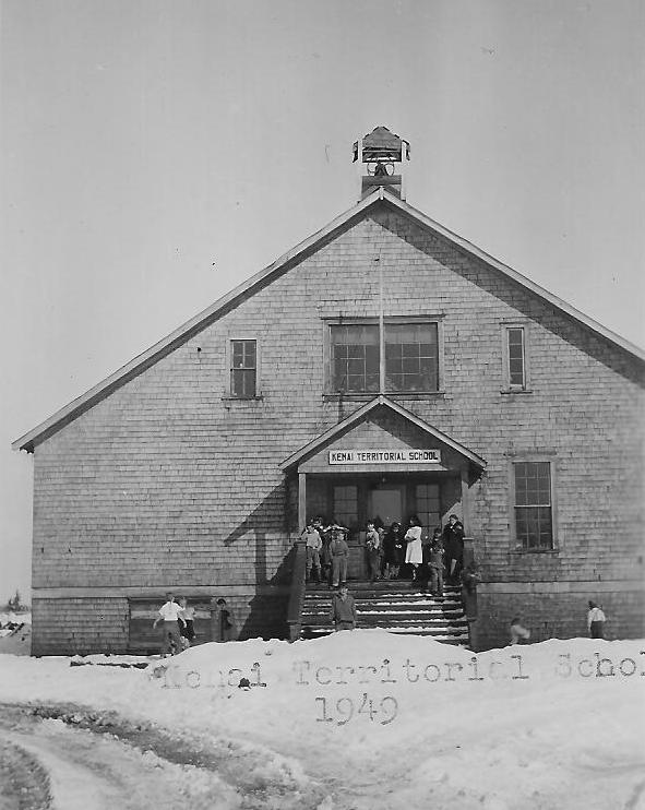
Kenai Territorial School 1949

1907: The American Territorial School of Kenai was established by the U.S. Bureau of Education. For a time, Dena’ina youth went to both the Orthodox school taught in Russian and the Territorial school taught in English.


1911: In Ninilchik, the first school sanctioned by the U.S. government was started.

1926: Alaska Glacier Tours Association had its first party of big game hunters. They hunted in the Tustumena Lake region.

1932: Areas north of Kenai River and Skilak Lake were closed to moose hunting, and the bag limit on sheep was reduced from two to one.

1940's: Homesteads were opened on the peninsula.  WWII veterans were given preference.

Kenai National Moose Range sign. USFWS
Sign for Kenai National Moose Range
1941: Kenai National Moose Range established. Signed by Franklin D. Roosevelt in December 16, 1941, 9 days after the bombing of Pearl Harbor.

1947: Forest fire burned 300,000 acres on the Kenai National Moose Range.


Early Alaskan Oil Well

1957: Oil discovered in the Swanson River Field by the Richfield Oil Corp, 20 miles northeast of Kenai. This was the first major oil discovery in Alaska.


Book Focused on Kenai Peninsula
Communities at Time of Statehood.
 1959: Alaska became the 49th State.


1961: 1st Borough Bill passed and signed by Governor Egan.

1963: 2nd Borough Bill, CS for House Bill No. 90, passed and signed by Governor Egan, directed that on Jan. 1, 1964 the Kenai Peninsula Borough be formed.

granite-point-oil-platform-alaska
Granite Point oil platform, Cook Inlet, Alaska. Photo source:
Greenpeace /Robert Visser By Dina Cappiello, Associated Press
1965: Oil was discovered offshore in Cook Inlet. Production wells both on land and from platforms in Cook Inlet produced both crude oil and natural gas.


1966: National Wildlife Refuge Administration Act created the National Wildlife Refuge system.

1968: Oil was struck by Atlantic Richfield at Prudhoe Bay.

Photo of Upper Kenai River.  USFWS
Upper Kenai River on the Kenai National Wildlife Refuge
1980: The Alaska National Interest Lands Conservation Act (ANILCA) changed the name of the Kenai National Moose Range to the Kenai National Wildlife Refuge, and established the following purposes:
(i) to conserve fish and wildlife populations and habitats in their natural diversity including, but not limited to moose, bear, mountain goats, Dall sheep, wolves and other furbearers, salmonoids and other fish, waterfowl and other migratory and nonmigratory birds;
(ii) to fullfill the international treaty obligations of the United States with respect to fish and wildlife and their habitats;
(iv) to ensure water quality and quantity;
(iv) to provide opportunities for research, interpretations, environmental education, and land management training; and
(v) to provide in a manner compatible with these purposes, opportunities for fish and wildlife-oriented recreation.

April 21, 1990 eruption cloud from Redoubt Volcano as viewed
to the west from the Kenai Peninsula. Photograph by R. Clucas

March 2009: Mount Redoubt volcano, 106 miles southwest of Anchorage began a series of eruptions after being in Orange or "Watch" status since late January 2009. Plume heights were observed at or above 60,000 feet during two of the six significant eruptions. Ashfall occurred over south central Alaska, including Anchorage, with amounts ranging from a trace to one-half inch in depth.


Photo by McKibben Jackinsky

May 2009: The continued shutdown of oil production in Cook Inlet due to the eruption of Mount Redoubt cost the state of Alaska approximately $1.5 million a month in tax revenue.
Eruptions also disrupted air traffic in the region. Hundreds of commercial flights were cancelled and cargo companies were significantly impacted. 


Photo By Tony Cella
2011: Ninilchik celebrated the100th anniversary of the Ninilchik School.


PART II - CAUSE-EFFECT STATEMENTS

1. Russian-American Company founds Kenai (1791) and Ninilchik (1835); employees of company build Russian Orthodox Churches (current buildings 1894 & 1901 respectively): churches start schools (Early 1860's, 1896).

2. Oil discovered on peninsula (1957) and in Cook Inlet (1965) creates jobs and experienced workers;  workers go to North Slope when oil discovered there (1968); families remain bringing North Slope dollars to peninsula. 

3. Mount Redoubt erupts (1990 & 2009); flights cancelled; employees laid off; military operations disrupted.

And an extra one that happens to be my favorite......

4. Big fire on peninsula, hunter dude from USA hunts giant moose, tells influential buddies about big moose, government bigshots hear about big moose and send forest ranger to check it out, ranger thinks peninsula a cool place, reports back, conservation observed, Kenai National Moose Range formed at beginning of WWII, more fires, Alaska National Interest Lands Conservation Act (ANILCA) changes name of Kenai National Moose Range to Kenai National Wildlife Refuge for purpose of fulfilling treaty obligations and conservation, hunter and fisher dudes and dudettes come to area with pockets full of cash to hunt and fish.

Sunday, April 15, 2012

Module IX -Alaska Governance and Contemporary Issues

Essential Question:  Describe the major reasons given for statehood and explain how those reasons are reflected in the Alaska State Constitution. 

Federal Land, Western Anger: The Sagebrush Rebellion and Environmental Politics (Development of Western Resources)
Book Covering Sagebrush Rebellion over States Rights
Back in the 1970's and 80's, many western states held that the federal government was overexerting its authority in determining the usage of federal lands in their states. Mostly, environmental issues were at the forefront.  Different special interest groups were lobbying the federal government to determine how these lands should be used.  In turn, the states took issue with the federal involvement. This movement became known as the Sagebrush Rebellion.  In one form or another, this issue of States Rights has been going on since the founding of our nation.  It and slavery were two of the biggest contributors to the Civil War.  It also provided much of the impetus driving Alaska and Alaskans to statehood.


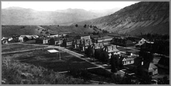
Historical photo of Fort Yellowstone
Historical Photo of Fort Yellowstone
From the time of the Alaska Purchase until statehood, the federal government controlled most aspects of government and commerce.  As was common during the late 1800's, when the federal government needed something administered, and it had no idea of how to do it, it sent in the military.  The U.S. Army was the first to "run" Alaska from 1867-1884 during what became known as the Era of Neglect because the federal government had yet to come up with a means to govern Alaska.  As a side note, the federal government did the same thing with the world's first national park, Yellowstone.  For over three decades beginning in 1886 (since there was not yet a National Park Service), the army was given the care and keeping of this new national resource.  Today, at the park's headquarters at Mammoth Hot Springs, the original barracks, stables, and other structures of the then Fort Yellowstone have been transformed into administrative buildings.

From 1884 until 1912 Alaska was a district. A civilian government was formed through the First Organic Act of 1884. The federal government still retained power as the President of the United States appointed government officials. Land owners could include miners and missions, but not Native Alaskans. Like the Sagebrush Rebellion that was still almost a century away, outside entities increased their interest and control over Alaskan resources.

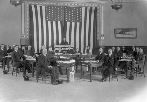
The 23 members of Alaska's first territorial legislature
assembled in the Elks Lodge Hall in Juneau, March 1913.
Photo courtesy of Alaska State Library and

Alaskan Southeaster Magazine
With the passage of the Second Organic Act of 1912, Alaska became a territory. Alaskans could now elect their own territorial legislature. Unfortunately, this governing body had limited powers. Virtually all of Alaska's land, natural resources, and even its government was controlled from Washington DC. After World War II, planning and preparation for statehood gained momentum as a state constitution was written during the winter of 1955-56. Even though special interest groups, including the salmon industry, increased their lobbying efforts due to the loss of influence that statehood would bring, the bill to make Alaska a state passed in 1958. On January 3, 1959, Alaska became the 49th state making its residents full citizens of the United States of America and giving Alaska all the rights and privileges entitled to the other 48 states.

Courtesy of University of Alaska Fairbanks UAF-1976-21-282  Statehood backers
celebrate: Alaska statehood backers and members of the U.S. Congress celebrate
 the final passage of the statehood bill in the Senate with a 49-star flag. From left, front row,
Sen. Warren Magnuson of Washington; Ernest Gruening, former governor of Alaska
and senator-elect; Sen. Frank Church of Idaho; Sen. Thomas Kuchel of California;
Alaska territorial Gov. Mike Stepovich; Sen. Harry M. Jackson of Washington;
and Rep.-elect Ralph J. Rivers. At left rear is Rep. Leo O'Brian of New York.
The already accepted constitution provided the means whereby the newly added state could function.  It provided for state and local governments where citizens from all across the state could have their voices heard and where decisions, when possible, were to be made at the local level.  (See: Article 10 - Local Government)
It has provided that all citizens have equal rights.  Article 1 - Declaration of Rights, Section 1, Inherent Rights reads:  "This constitution is dedicated to the principles that all persons have a natural right to life, liberty, the pursuit of happiness, and the enjoyment of the rewards of their own industry; that all persons are equal and entitled to equal rights, opportunities, and protection under the law; and that all persons have corresponding obligations to the people and to the State."

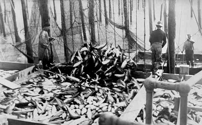
It also strikes a decisive blow to the powerful Salmon Industry, both literally and metaphorically. In the constitution, Ordinance No. 3 - Abolition of Fish Traps states: "As a matter of immediate public necessity, to relieve economic distress among individual fishermen and those dependent upon them for a livelihood, to conserve the rapidly dwindling supply of salmon in Alaska, to insure fair competition among those engaged in commercial fishing, and to make manifest the will of the people of Alaska, the use of fish traps for the taking of salmon for commercial purposes is hereby prohibited in all the coastal waters of the State."


Examine Question:  Identify the Alaska Senate and House Districts in which you live (Use current, not pending, letter and number.) Identify the name and political party of your state senator and representative. Identify the type of local government you have (city? borough? what class?) Identify the tribal government, if any, in your area, and if possible find out if it is an IRA or traditional council.

Alaska Legislative Districts 2002-2012


Senator Tom Wagoner (R)
Representative Kurt Olson (R)
Soldotna is part of House District 33, represented by Republican Kurt Olson.  Soldotna's Senator is Republican Tom Wagoner of District Q.  Soldotna is an incorporated 1st Class City in the Kenai Peninsula Borough.  It has a Council-Manager form of government with The Honorable Peter A. Micciche as Mayor.  The governing council consists of six members and the mayor.  It was not included in the Alaska Natives Claims Settlement Act therefore it is not recognized as a Native Village. 


Three Blog Reviews:
In The Alaskan Adventure Lane does a great job of personalizing and giving his views of the PFD.  Nicely written, good layout, cool graphics.

Heather does a good job of explaining ANILCA and its ramifications.

Kelley makes a great statement:  "One thing that I have discovered is the land that Natives call their home isn’t just home because of the financial value. It is home because it is a way of life, it is what they know. The resources that Natives use the land for go so much farther than the bank."  Well done.

Evaluate: So much to go over and all of it essential to the course.  I found all of it interesting and only wish I had more time to explore and digest all of it.  The Alaska Constitution is indeed quite the document.  I really enjoyed the series of videos that covered its origin and the details that went into its creation.  It really brought home the idea that everyone there had the goal of coming up with a document that would represent all Alaskans and that would remain a viable work well into the future.

Saturday, April 7, 2012

Module VIII - World War II 1939-45 A Turning Point for Alaska

Essential Question:  Explain how Alaska's location was considered 'strategic' during World War II. What were the war activities/events that supported the perspective of 'strategic' Alaska?

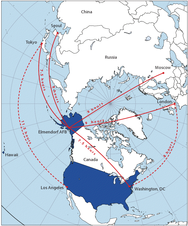
Even today, Alaska is in a strategic location. Most notably, the Aleutian Islands sit on Pacific Great Circle routes. The Aleutian Islands Risk Assessment website reads: "A great circle is the shortest distance between two points on a sphere. Vessels transiting an ocean between two continents may follow a great circle route because it is the shortest distance, or they may deviate from the great circle route where favorable weather and sea states allow for faster travel. 


On many map projections a great circle route is not a straight line.  Above, Figure 1 shows a gnomonic map projection of the North Pacific where the great circle route is a straight line. As seen on this map, a great circle route from Yokohama, Japan to Seattle passes through Unimak Pass and the Aleutian Islands. Figure 2 shows this same route on a Mercator projection where, because the map is flat and the earth is curved, the route appears as a “great circle,” or more accurately, a semi-circle."


Alaska’s strategic location. Map courtesy of The
State of Alaska, Office of Governor Sean Parnell.
Remember way back in Module II where General Billy Mitchell in the 1930's came up with the idea that Alaska is at the center of the earth?  He also stated to the U.S. Congress in 1935, "I believe that in the future, whoever holds Alaska will hold the world. I think it is the most important strategic place in the world."   The U.S. thought that if Japan got a foothold in the Aleutians, they could mount an aerial attack on the Western United States.  The Japanese were thinking this way also.  They believed that their presence in the Aleutians would prevent a U.S. attack on Japan through the Northern Pacific.  Both sides saw the strategic value that the Aleutians had on controlling the Pacific Great Circle routes.

Major Marvin R. Marston also felt strongly about the importance of Alaska's strategic location.  He said, “The nation’s whose air bases are nearest the North Pole will be feared most and have the least to fear.”


Lend-lease B-25s and P-39s on the runway at Ladd Field, Alaska,
prior to testing by the Soviet Purchasing Commission,
September 1942. (U.S. Air Force photo)
Another event that took place later in the war that utilized the  strategic location of Alaska was the Alaska -Siberia Project (ALSIB).  This was Alaska's version of the Lend-Lease program that was being used to support other Allied forces in other battlefronts.  In it, airstrips, airports and radio ranging stations were built in British Columbia, the Yukon and Alaska to facilitate the transport of U.S. made military planes to the Soviet Union. Between September 1942 and September 1945, the Soviet Union accepted almost 8,000 aircraft at the official transfer point, Ladd Field in Fairbanks. Once transferred to Soviet control, Russian pilots took them another 3,500 miles through Nome to the Soviet Union.  Even though there were no hostilities along the route, the Alaskan weather accounted for its share of downed planes.

This Douglas A-20G Lend Lease aircraft in Alaska awaits
delivery to the Soviet Air Force. Note the long range fuel
tank mounted in the bomb bay and the engines being
heated prior to start. (U.S. Air Force photo)


Examine Question:  Describe the recruitment, training, and the role of the Alaska Scouts.

I really hope that this is OK, but I changed this examine question a little. I came across the Alaska Scouts and could not stop reading about them.  As a matter of fact, it probably took me more time to find the information about them as it did to actually read about them.  However, what I found was fascinating.

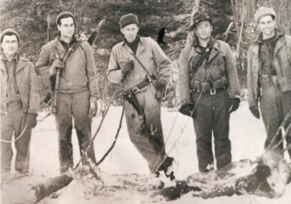
Some of Castner's Cutthroats
Only six months after the bombing of Pearl Harbor, in June of 1942, the Japanese bombed Dutch Harbor and invaded the Aleutian Islands of Attu and Kiska.  Lieutenant General Simon Buckner was given the task of taking back Alaska.  Because of the primitive conditions and lack of roads and communications.  Colonel Lawrence Castner, one of Buckner's intelligence officers, proposed recruiting an elite unit of Alaskan natives, trappers, and hunters to act as scouts for the army.  These men needed to be and were at home in the wilds of Alaska.  These "Alaska Scouts" were officially known as the 1st Combat Intelligence Platoon (Provisional), later to become known as Castner's Cutthroats.  The reason they took on this added moniker was because they did not have to conform to military protocols.  They dressed in their own civilian clothes with little or no military markings.  They were given the freedom to choose weapons based on personal preference.  Even shaving and bathing were optional.

Picture
Alaska Scout William "Billy" Buck
Recruitment and training went hand in hand.  These men were already experienced hunters and outdoorsmen.  As recruits, they were were intensively trained in commando operations.  By design, they travelled with a minimal amount of gear.  They lived off the land and did so quite well.  During the Aleutian Campaign, the Cuttrhoats would be the first to land on a new island and give a report back to the military leaders.  On Adak Island, their mission was to locate a suitable site for an airstrip for a forward air base.  Finding no enemy when they landed and finding no place for a suitable landing strip, they suggested draining a sandy bottom lagoon.  Once it was built, the Americans now had a landing field half way between Dutch Harbor and the Japanese.

After that, the Cutthroats were given the task of taking Amchitka, just 50 miles east of Japanese occupied Kiska.  The landing was perilous due to a nasty winter storm and even though 14 sailors drowned, all the Cutthroats survived.  Once again, no Japanese were found on the island, the all clear was given and 2,000 GI's landed.  Unfortunately, due to the same storm, most of the food supplies were lost.  Castner's Cutthroats saved them from exposure and starvation by teaching them how to survive with the resources at hand.

[Photo] Seventh Infantry Division troops landing at Massacre Bay, Attu, May 1943.
(Courtesy Elmendorf Air Force Base History Office, Alaska)
Seventh Infantry Division troops landing at Massacre Bay, Attu, May 1943. 
For the final push, they proved invaluable.  Hiking across 30 miles of treacherous terrain, they set up an observation post to view enemy activities on Kiska.  They were able radio back to the airfield letting them know of bombing raids headed their way.  When it came time for the invasion of Attu, the Cutthroats led the way.  Spread out between units as guides and sharpshooters, the outdoorsmen used their lethal hunting skills by stalking and killing Japanese snipers and machine gun crews.  After a year of intense struggle, Alaska was back in American hands, thanks to the homegrown scouts who guided the way and helped the unprepared U.S. Army survive the extreme environment.


Three Blog Reviews:
I liked Niki's use of pictures and links  I flowed well and kept me engaged.

Claire did a nice job of using local history.  Interesting.

Betty also did a nice job of using local history and great pictures.


Evaluate:  This Module was just packed with all kinds of really great stuff to look up and learn about.  As I said above, I just couldn't stop reading and looking for more information on the Alaska Scouts aka Castner's Cutthroats.  Here's an expert from the Alaska Veteran's Museum"Lt. Acuff and Sgt. Walker came to Alaska from different wartime posts in the Lower 48. Neither of them fit in nor liked to follow the rules, they said, but both were good outdoorsmen and survivalists.....Walker first met Acuff on a remote Aleutian island. Acuff was dispatched to the island to watch for Japanese planes. He was told to keep radio silence unless he saw the enemy. The Army never heard from Acuff and thought he was dead. Walker and a few men were sent to recover Acuff's body. Walker first spotted Acuff on a mountain as Walker's boat approached the beach.

“He came down that mountain, and I swear he was taking 10-foot steps,” Walker said. “He came down that mountain and up the beach and he wasn't even breathing hard. He was one super man.”

It turned out that Acuff hadn't seen any enemy planes and was enjoying living off of king crab, ptarmigan and halibut.

The men had many adventures together during the war; they slept in spruce-bough beds in tents on Fort Richardson; they caught and cooked their own food on post, built smokehouses to smoke two tons of salmon, managed dog teams and trained other soldiers to live off the land."

Sunday, April 1, 2012

Module VII - American Period: Society

Essential Question:  How have the settlement patterns of Alaska been a reflection of the natural landscape, distance, resources, and the economy?


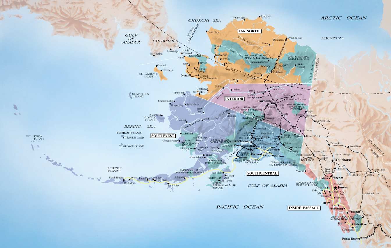
As can be seen from the above map, the face of Alaska reflects past and current trends in transportation and commerce.  I purposefully made it ginormous to make individual communities, roadways, railroads and the ever present mountain ranges more visible.

Alaskan packers and miners row boat on Yukon River, Alaska, ca. 1901
Alaskan packers and miners row boat on
Yukon River, Alaska, ca. 1901
From the very beginning, people have built communities in Alaska near the ocean or major waterways that acted as travel routes.  Even in the winter, frozen rivers acted as highways for dog teams.  Because of topography, transportation by boat was the easiest way for people to get from point A to B.


This photo, used by author Janet Klein in her book "Kachemak
Bay Communities — Their History, Their Mysteries," indicates
this view of Homer would have greeted anyone in 1901. The
boardwalk, train rails, activity activity and sacks which are
probably full of coal suggest a permanent community.
However, Klein says, Homer was abandoned in 1902
and only a caretaker lived there in 1907.
Initially, after the purchase of Alaska, Americans replaced the Russians who left and utilized the communities they had established.  After that, and until the discovery of gold in 1898,  a few communities in Southeast Alaska were founded based on the development of local activities such as mining, logging, and fishing.  In Southcentral Alaska, cannery sites grew into villages and in Northwest Alaska whaling stations were established.


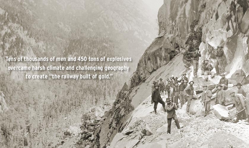
The 110 mile WP&YR Railroad was completed with the
driving of the golden spike on July 29, 1900 in Carcross Yukon
 connecting the deep water port of Skagway Alaska to Whitehorse
 Yukon and beyond to northwest Canada and interior Alaska.
The 1898 Klondike gold rush changed the face of Alaska.  The population nearly doubled virtually overnight to about 63,000.  Communities near where the gold was found came to be such as Nome, Fairbanks, and Circle City.  Other towns, such as Skagway, Valdez, and Dyea came into existence as supply camps to support those who came to Alaska seeking their fortunes.


Early Anchorage
Anchorage July 1, 1915
  Later, into the 1900's, establishment of new communities occurred as roads, railroads, and the Washington-Alaska Military Cable and Telegraph System were built.  Each required a large labor pool.  Seward, Cordova, Anchorage, and Nenana are just some of the communities that resulted from this need for workers.  Today, it is little wonder that Anchorage, Alaska's largest city, lies at the confluence of road, rail, and ocean travel.

(Keep reading!)


Examine Question:  What are the reasons for Alaska population trends? (Identify reasons for increases and decreases.)

By 1910, the allure of fame and fortune was over as the gold played out. The population went down, yet it was still higher than it was before the gold rush began. Work could still be found associated with mining, fishing, or government funded construction projects. There was a further drop as America entered World War I. During this time, Alaska had the highest military recruitment per capita than any of the states. (This was significant because Alaska would not become a state for almost another half century!)


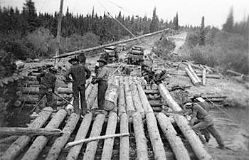
Men constructing timber bridge, 1942
Building the Alaska-Canada Highway

Along came World War II and national defense put Alaska in the forefront.  The construction of military installations (including army posts, naval stations, and air fields) and major roads, like the Glenn and Alaska-Canada Highway brought thousands of military personnel and civilians to Alaska. Then.........


Components of population change for Alaska 1947 to 2011


Alaska population trends 1946 to 2011


Three Blog Reviews:
Peter's Alaska Blog:
I like how Peter took his essential question and answered it on a local basis.  Great information about his area of the state.  Well done!

Learn Alaska or Bust:
Chris did a nice job of answering his question in a creative way.  I like how he integrated and tied all his questions together.  Nicely done.  Great moose picture also!

Surveying Alaska's History:
I enjoyed Robin's dissertation on education and health care.  The use of pictures and links in the text enhanced the theme.  Good job!

Evaluate:  I am not sure if it was the spring break thing or what, but I had a hard time getting into this module.  Not that it wasn't interesting, it was.  I found myself reading and rereading the material, then reading and rereading the questions trying to decide which questions I wanted to answer.  I would choose, begin on a question and then change my mind and start over with another question.  As it turned out, I seemed to have an infatuation with pictures on this module. So much for me getting this module done early so that I could get a jump on the next one.